The Approach to the Warrego Country map, c. 1845
On this page...
Curators’ acknowledgement
“We pay our respects and dedicate the Unsettled exhibition to the people and other Beings who keep the law of this land; to the Elders and Traditional Owners of all the knowledges, places, and stories in this exhibition; and to the Ancestors and Old People for their resilience and guidance.
We advise that there are some confronting topics addressed in this exhibition, including massacres and genocide. Aboriginal and Torres Strait Islander peoples should be advised that there may be images of people who have passed away.”
Laura McBride and Dr Mariko Smith, 2021.
Warrego Country map
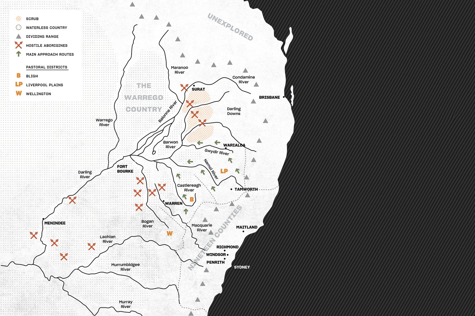
The Approach to the Warrego Country map, c. 1845.
Image: Australian Museum© Australian Museum
This map illustrates how parts of New South Wales and Queensland were not only mapped out by the colonisers in terms of land use potential, but also to identify threats from the “hostile Aborigines” of those regions.
It is based on one of numerous colonial historical records which document how Aboriginal people were unwelcoming to those who were expropriating their lands without negotiation or agreement.
This truth lives on, not only in the living memories and oral histories of First Nations peoples, but in the written archive.
Did you know?
Fort Bourke, featured on this map of the Warrego Country, was a fortified depot built by Major Thomas Mitchell in 1835, to protect the colonists’ stores from attacks by hostile local Aboriginal people. The district and the town became known as Bourke.[1]
References:
- Monument Australia, Fort Bourke Stockade. From https://monumentaustralia.org.au/themes/landscape/exploration/display/20483-fort-bourke-stockade
